
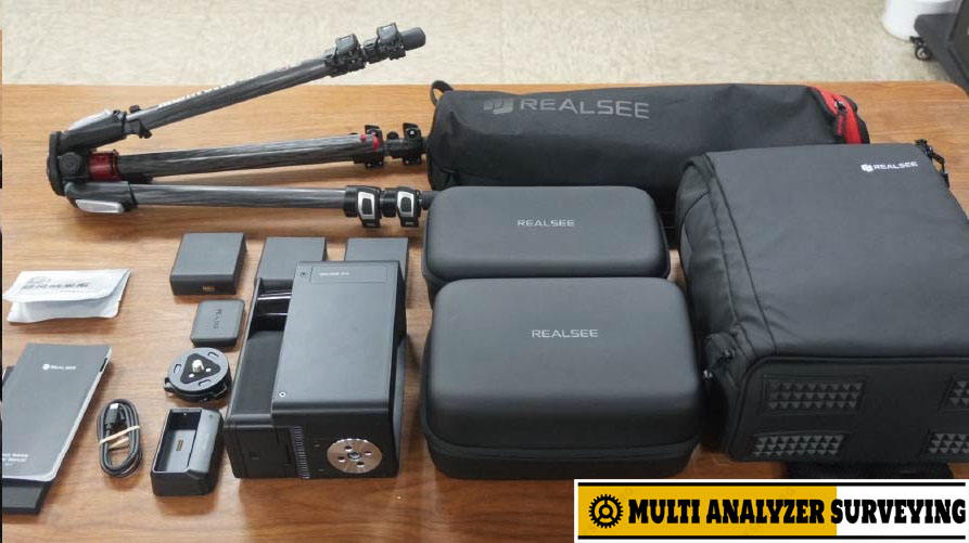
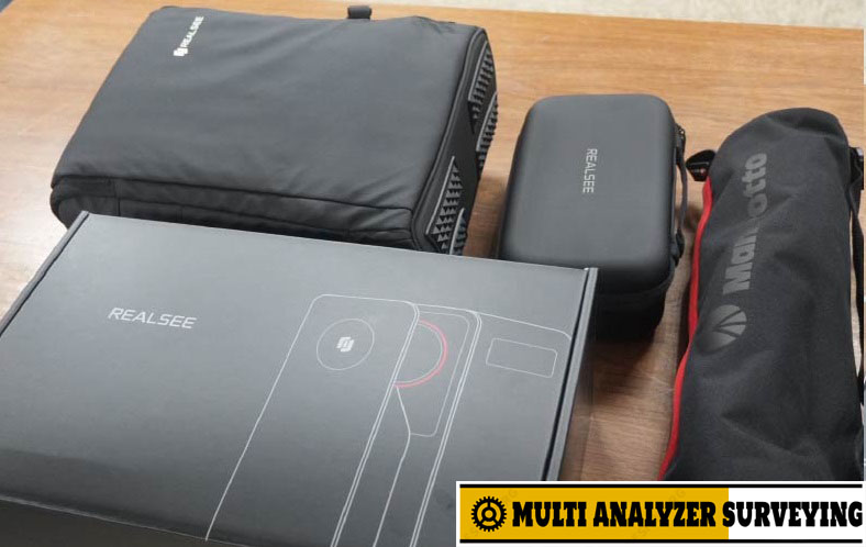
Realsee Galois P4 3D Lidar Scanner
Key specifications
| Specification | Galois P4 |
|---|---|
| LiDAR | 905 nm laser LiDAR |
| Maximum range | 100 m @ 90% reflectivity |
| Measurement error | < ±10 mm @ 0.1–15 m |
| Point-cloud rate | 125,600 points/sec |
| LiDAR FOV | 360° × 213.25° |
| Scan time | ~16 seconds per scan position |
| Camera | Approx. 47–48 MP, 4/3″ CMOS |
| Panorama | Up to 300 MP / 24K |
| Storage | 512 GB |
| RTK | Yes |
| Battery | Up to 3 hours |
| Charging | Approx. 2.5 hours |
| Weight | 2.6 kg, including battery |
| LiDAR safety | Class 1 |
Specifications are from Realsee‘s current product information; some regional pages show slightly different FOV/panorama figures, so the exact firmware/market configuration should be confirmed before purchase.
What makes the P4 interesting
1. Fast field capture
Each scan position takes approximately 16 seconds, with Realsee claiming a 1-second point-to-point stitching process. The company estimates a 100 m² space can be captured in roughly 8 minutes under suitable conditions.
2. Dense point clouds
The 125,600 points/sec capture rate and 100 m range make it considerably more than a conventional 360° camera. Realsee positions it for point clouds, spatial documentation and digital-twin workflows.
3. High-resolution imagery
The P4 combines LiDAR with a 4/3-inch imaging sensor and approximately 47 MP camera. Realsee advertises 24K 3D tours and up to 300 MP panoramic imagery, plus HDR and 8× lossless zoom.
4. Multiple deliverables
Depending on the workflow/service package, one capture can produce 3D tours, point clouds, 3D models, floor plans, CAD-oriented outputs and high-resolution panoramas. Realsee also specifically lists E57 and PLY point-cloud export.
Typical applications
- 🏗️ Construction documentation — existing-condition surveys and progress documentation
- 🏢 AEC/BIM — point-cloud acquisition and scan-to-BIM workflows
- 🏠 Real estate — immersive 3D property tours and floor plans
- 🏭 Industrial/commercial spaces — warehouses, factories, retail and facilities
- 🏛️ Museums/tourism — digital preservation and virtual experiences
- 🌐 Digital twins — spatial visualization and documentation
P4 vs. a conventional laser scanner
The important distinction is that the P4 is designed as a hybrid capture platform. It combines LiDAR spatial data with extremely high-resolution visual capture and Realsee’s 3D-tour ecosystem. That makes it particularly attractive when you need both an immersive presentation and usable spatial data from the same site visit.
For highly demanding metrology, however, the advertised ±10 mm specification is only stated for 0.1–15 m, so it should not automatically be interpreted as a ±10 mm accuracy guarantee across the full 100 m range.
Price
Realsee’s current product listing shows approximately US$7,499 for the Standard Kit, with a Premium Bundle listed at approximately US$7,999. Regional pricing can differ.
Bottom line: The Galois P4 is particularly compelling if your priority is fast scanning + high-quality imagery + point clouds + digital-twin/3D-tour outputs rather than pure survey-grade terrestrial laser scanning.
A useful next step would be to compare the Galois P4 against Matterport Pro3, Leica BLK360 G2, FARO Focus and Trimble X7 on accuracy, scan speed, point-cloud density, registration and price.



There are no reviews yet.