
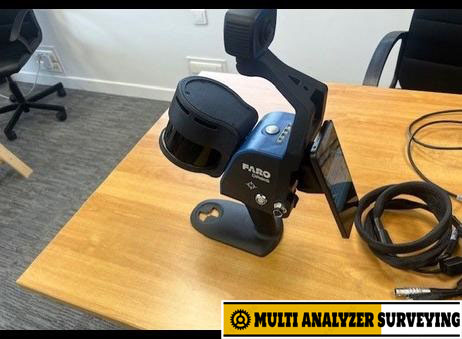
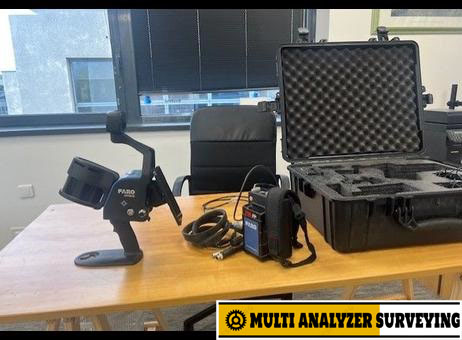
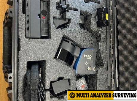
Sale – FARO ORBIS laser scanner
Key specifications
| Specification | FARO Orbis |
|---|---|
| Scanning range | Up to 120 m |
| LiDAR channels | 32 |
| Point measurement rate | 640,000 points/sec |
| Field of view | 360° × 290° |
| Mobile scanning precision | Up to 5 mm |
| Stationary Flash precision | Up to 2 mm |
| Flash scan time | ~15 sec |
| Flash resolution | 19 million points |
| Battery | Typically ~3 hours |
| Internal storage | 512 GB |
| Scanner weight | 2.1 kg |
| Scanner + datalogger + battery | ~3.6 kg |
| Laser safety | Class 1, eye safe |
| Operating environment | Indoor & outdoor |
These figures are from FARO’s current specifications; precision is specified as one sigma.
How it works
1. Mobile SLAM scanning
You walk through the building, plant, tunnel, site, forest, etc. Orbis continuously maps its surroundings using LiDAR and SLAM. This allows relatively large areas to be captured without setting up a tripod at every position. Mobile precision is specified at up to 5 mm.
2. Flash scanning
For areas requiring more detailed stationary capture, you stop and perform a Flash scan. A stationary scan takes approximately 15 seconds and has specified precision of up to 2 mm.
3. Processing
Data can be processed locally using FARO Connect, with FARO SCENE available for advanced registration. FARO also offers cloud processing through Sphere XG.
Typical applications
- Building / BIM documentation
- Construction progress and as-built surveys
- Plant and factory mapping
- Industrial facilities and MEP documentation
- Underground mines and tunnels
- Public safety / accident and crime-scene documentation
- Architecture and engineering
- Forestry and difficult outdoor environments
- Large-area indoor mapping
A major advantage is the ability to transition between indoor and outdoor environments while scanning.
Orbis vs. Orbis Premium
There are two important versions to distinguish:
| Orbis | Orbis Premium | |
|---|---|---|
| Mobile SLAM | ✓ | ✓ |
| Flash scanning | ✓ | ✓ |
| Mobile precision | Up to 5 mm | Up to 5 mm |
| Flash precision | Up to 2 mm | Up to 2 mm |
| Range | 120 m | 120 m |
| 360° imaging | ✓ | Higher-resolution camera system |
| Point-cloud colorization | Limited/different configuration | ✓ |
| Ruggedization | — | IP54 |
| Typical use | General mobile mapping | More demanding field work / visual documentation |
FARO describes the Premium as adding a more powerful camera and IP54 protection.
One important consideration
Orbis is not simply a faster conventional tripod laser scanner. Its principal strength is rapid SLAM-based mobile capture. The quoted 5 mm mobile precision and 2 mm stationary Flash precision should therefore be considered in the context of the respective scanning modes. For applications demanding very high global survey accuracy, control points and/or registration with conventional terrestrial scans can still be important. FARO supports control-point capture and registration with Orbis, Flash and Focus scans.
FARO Orbis official product page
If you’re evaluating it for surveying, BIM, construction, plant inspection, or as-built measurement, I can also compare FARO Orbis vs Leica BLK2GO / RTC360 / NavVis VLX / XGRIDS PortalCam / Realsee Galois P4 in a technical specification table.





There are no reviews yet.